

You have data, you want a map on your website that tells the story... just Plug and Play! This free web service lets you create engaging, interactive thematic maps in your web pages with 1 short line of code that you can create with our online Designer (plus 1 short line provided by Google). Forget about HTML, Javascript, mapping APIs, and file formats! Just point to your data and tell us how to display it with a few simple words!
The Plug and Play Maps free web service:
- creates your interactive thematic map and legend automatically
- works with your data in many formats
- lets you map as many datasets as you like - each one gets its own appearance, legend, and control
- locates features by lat-lon, by street address, or by country or state codes
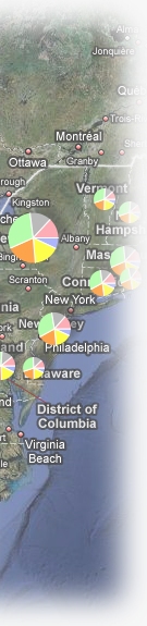
- provides eye-catching choices for displaying your data to reveal the information it holds
- does it all with 2 simple lines in your web page (and we'll even help you with that!)
Here's a short screencast that shows how easily you can create your own map (if the embedded player is missing you can watch it on YouTube):
Plug and Play Maps can be used in a variety of ways to match your needs. Browse the examples in the gallery or follow the link below that describes how you'd like to create your map:
- from spreadsheets or similar tabular files
- from Google Docs spreadsheets
- from KML or KMZ ("Google Earth") files
- from GIS shapefiles
- from data in a web database
As the name implies, the whole point of Plug and Play Maps is to make it as simple as possible to put maps on your web pages. There are just two quick steps you need to take to get your maps going. Once you have your maps in place, you may want to explore the How To topics to learn about more easy ways to enhance the appearance and usefulness of your maps. Happy mapping!